Sjeanmarc
-
Gesamte Inhalte
35 -
Benutzer seit
-
Letzter Besuch
-
Tagessiege
2
Inhaltstyp
Profile
Forum
Galerie
Glossar
Magazin
Alle erstellten Inhalte von Sjeanmarc
-
I hiked last year partly on High Skardus Trail but I tried to stay most of the time in North Macedonia to avoid the problem of border crossing. When I was in Kosovo, I stayed high in altitude. I went in Albania just 2 days and back through the mountains to North Macedonia. See more information about my hike on Macedonia
-

Spanien -> Valencia/Castellón/Aragón: Erfahrungen mit dem GR 7 oder GR 8?
Sjeanmarc antwortete auf Maestrazgo's Thema in Tourvorbereitung
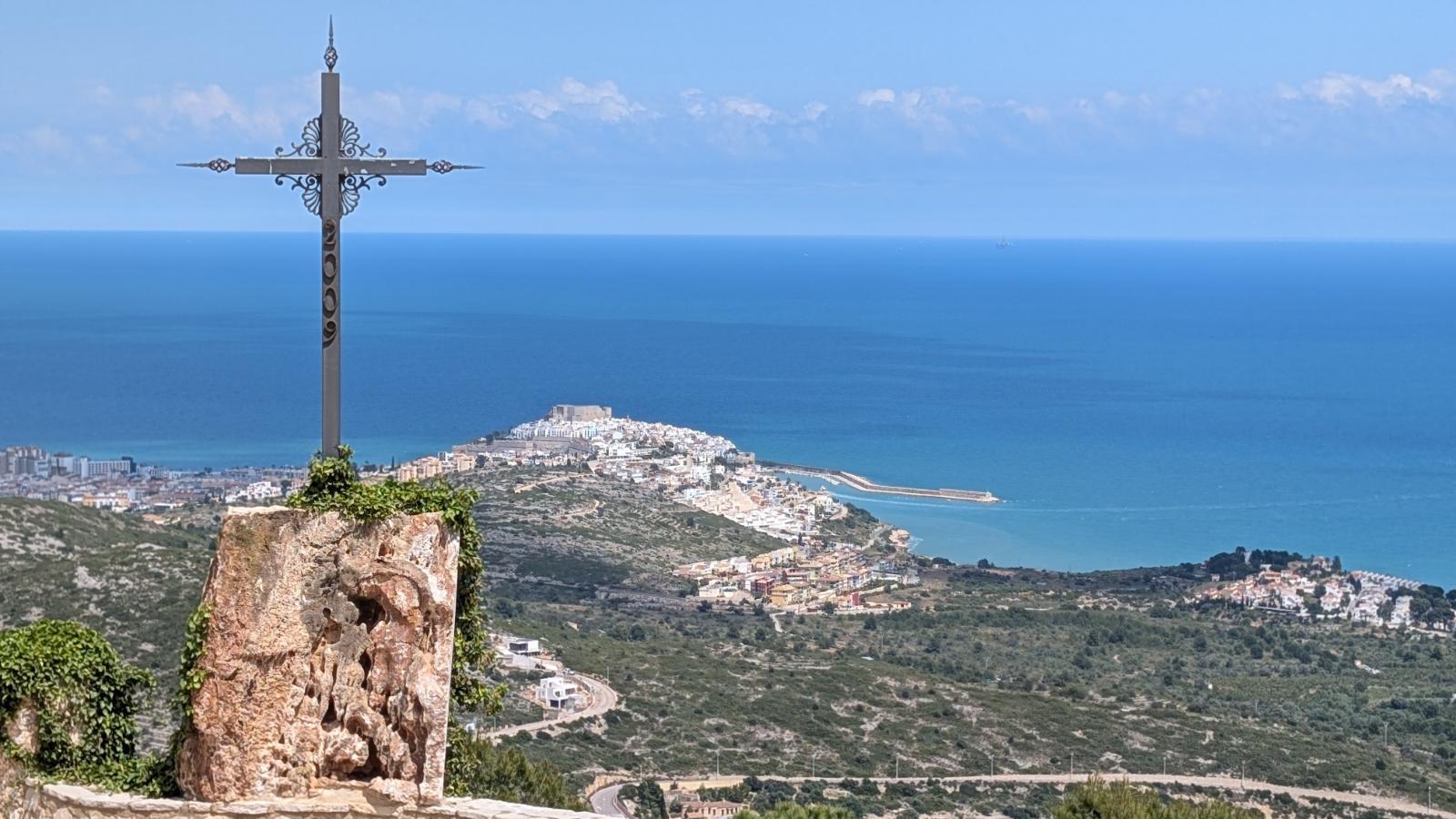
Not exactly GR8 but this spring, I hiked through Spain and from Aliaga to Peniscola, there are some spectacular places. I put details and GPS track on the page North Iberian Cordillera
-
Spanien -> Valencia/Castellón/Aragón: Erfahrungen mit dem GR 7 oder GR 8?
Sjeanmarc antwortete auf Maestrazgo's Thema in Tourvorbereitung
Hello The part you choose for 6 days to Morella is a good option. I hope you'll enjoy it. -
Spanien -> Valencia/Castellón/Aragón: Erfahrungen mit dem GR 7 oder GR 8?
Sjeanmarc antwortete auf Maestrazgo's Thema in Tourvorbereitung
Hello Sorry, I'm replying in English (I don't speak German). I hiked GR7 in 2023. The section between Siete Aguas (near Valencia) and Benifallet (after Morella, along the Ebro River) is nice, and some parts are truly magnificent and spectacular. There are not many hikers but the path is mostly well marked. For more information (water, resupply, accommodation, daily stages), see the link: GR7 Espagne -
I hiked through Balkans (Cyprus, then Crete, Peloponnese, Central Greece, Albania and Via Dinarica) in 2018. If interested, I put all the information (GPS track, accommodation, resupply...) on the page about Balkans with a more detailed page for each part of this hike.
-
With the right link : From France to Barcelona (GR92). In Liguria, yes I hiked all the way along the coast. In fact I hiked all Italy from Sicily to France. Then, it's possible to hike in France partly along the coast on Via Aurelia.
-
Here are my feedback after having hiked along the coast from Tuscany to France: Liguria From France to Barcelona, it can be also a good option.
-
For Armenia, you'll find plenty and detailed information on the website of Transcaucasian Trail. I hiked through Armenia (and then Georgia and Turkey) in 2022. It's one of my best memories with very different landscapes along the way, wonderful people, very interesting history. You'll find my feedback with my GPS track (sometimes different from the Transcaucasian Trail), where to find water, resupply, accommodation... on the page Armenia
-
I hiked Via Algarviana. It's mostly gravel roads. Not a lot of path, neither asfalted roads. I didn't have trouble to wild camp. With the link the information where I found water, resupply: Via Algarviana
-
Hello. I hiked from Bulgaria to Romania, leaking Balkan mountain (Kom Emine) to Carpathians mountains in Romania through a part of Serbia. You'll find with the link the GPS track, my stages ... : Bulgaria - Serbia
-
I hiked from Nazaré to Cascais via Peniche this year (in July). The coast is beautiful and there are almost nobody hiking. With few improvements, this way could rival others coastal paths like the Rota Vicentina. It's not always well marked and as I tried to stay as close as possible to the ocean and avoid the roads, there are some passages that are a bit wild or aerial. I put information (GPS track...) on Portugal East to West
-
In addition to the previous messages, I hiked Jordan Trail mid February to mid March 2024. I updated information (GPS track, water, resupply) on my blog. Dogs : I found dogs less aggressive than in Balkans, Romania or Türkiye. They bark, approach but keep a certain distance, especially if you have stones in your hand (or if you pretend to have them). Water : I made my stages in order to sleep each night with water nearby. This significantly reduces the amount of water to carry but it led me to do some long stages. Since it wasn’t hot, I never carried more than 4 liters. Difficulties : The Jordan Trail is not an easy path. It is only marked in the north (near Israel, due to GPS jamming, it was even more difficult to follow the track). In the desert you have to carry enough water and sometimes you have to walk in the sand. The second part includes quite long sections in autonomy and there are daily elevation gains. Even the north has steep and challenging climbs. Jordan Trail / INT In fact, in September I took a plane ticket and I wanted to hike Israel National Trail and Palestinian Heritage Trail. I had to change my plan and finally I think Jordan Trail has a lot of assets: - it's easier to deal with water. I always slept in places with water. It seems more difficult without water caches on the INT - I saw pictures of INT when I prepared my hike but how can you compete with Wadi Rum or Petra? - the cost of living is cheaper in Jordan. You can find accommodation at interesting prices (half board at 30€) - the hospitality of Jordanians is incredible.
-
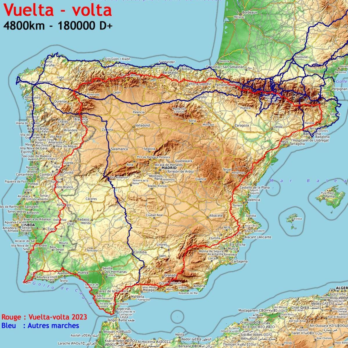
I updated all the information (GPS tracks, water, resupply, accomodation...) about this long distance hike. 4700km - 160000m of positive ascent - 128 days hiking - 5 months all together (injury, bad weather...). Feedback: perhaps the only such long distance hike doable in one go with good weather conditions. Almost all the way out of asphalted roads. Very varied landscapes : ocean at the beginning, countryside, small typical villages and the superb Pyrenees - Cantabrian Mountains to finish (with the 3 highest peaks on the way). A lot ideas off the beaten track paths in Portugal and Spain.
-
Tagestouren in Spanien Nähe Valencia gesucht
Sjeanmarc antwortete auf hiker's Thema in Tourvorbereitung
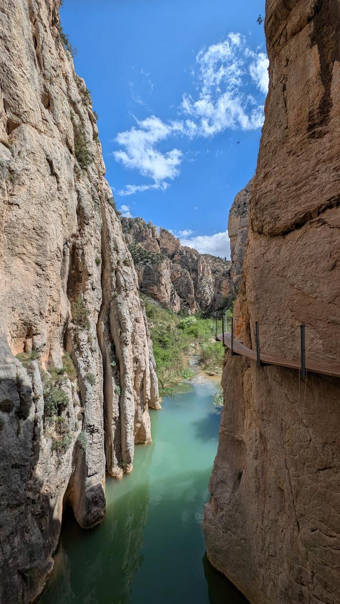
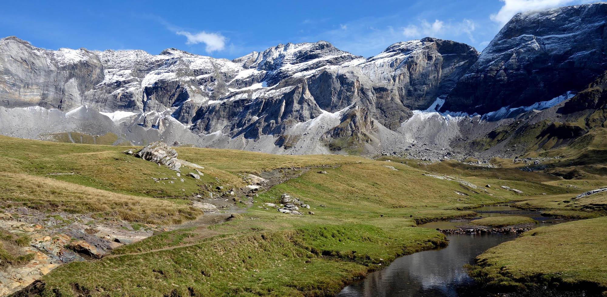
I walked last two days around Chulilla and there are spectacular hikes around. Also it's very beautiful around Cortes de Pallás. Some pictures are on my website at the page Vuelta-Volta -
I hiked in 2020, starting in Lauterbourg June 17th. I was in the Alps (Mount Thabor) July 20th and from there I went to the Pyrénées (HRP) to reach the Atlantic Ocean (Hendaye) September 7th. I hiked from Mount Thabor to Mediterranean sea when I did Via Alpina in August 2021.
-
From Alsace (Lauterbourg) to the Mediterranean inspired by the path GR5, it took me 44 days hiking : 11 days for the Vosges, 9 days for the Jura, 13 days in the Alps to Mont Thabor and then 11 days to Menton.
-
Vuelta Volta: After a long distance hike in Caucasus and Turkey in 2022, this year back in Europe with the Vuelta-Volta : 4800km around the Iberian Peninsula linking existing paths (Via Algarviana, Rota Vicentina, Alta Via Cantábrica, GR11, GR7...). Start march 5th. All information (GPS track, resupply, accomodation...) on Vuelta Volta.
-
For those interested, I'm back from my hike through Armenia, Georgia and Turkey. From the iranian border to Istanbul, I hiked 3200 kilometers, 105 days mostly on paths, gravel roads and almost without asphalt. The hospitality, the scenery are extraordinary. I updated all the information (water, resupply, GPS tracks) : Caminaire
-
Vorbereitung und Planung Sentiero Italia 2022
Sjeanmarc antwortete auf Mia im Zelt's Thema in Tourvorbereitung
Hello. I didn't have problems to find gas canisters in Italy buying those in Decathlon stores (in all the big towns). It's possible to click and collect those. If you need information for places to resupply along the way, I put information for the different areas of Italy. See the link Italy 2021 -
[SUCHE] den PERFEKTEN Trek mit folgenden Parametern...
Sjeanmarc antwortete auf freiwanderer's Thema in Tourvorbereitung
Central Greece, Albania, Romania, Bulgaria, Via Dinarica...all these countries can answer to your demand for wild mountains, wild camping and weather still ok in September. I hiked through all these countries in the mountains and it's really beautiful. -
Sardinien – Tipps, Empfehlungen, Erfahrungen?
Sjeanmarc antwortete auf mmaddin's Thema in Tourvorbereitung
I hiked through Sardinia north to south last year. If you want to hike few days, I recommend the part from Oliena to Ulassai. On this way, you'll have mountains with the highest mountain of Sardinia, Nuraghe historical ruins (Tiscali, Serbissi), Gorropu canyon, Perda e Liana mountain... I wild camped most of the nights. Water is rare but doable in spring. I put more information on this page Sardinia -
Hello. If you start in April the Hexatrek, you will be in the Alps in may, too early. There will be too much snow. Going from the south, April is far too early for the Pyrenees. The only options I see is to start from somewhere in Germany and arrive in June in Vosges or to start in south of Spain to be in the Pyrenees mid June.
-
For the Sentiero Italia, the website of Va Sentiero gives a lot of information. I hiked through Italy in 2016 and 2021. Sometimes it's tougher than in France because the trail doesn't exist anymore.
-
If you are interested for hiking through France, in 2020, I hiked through the mountains (Vosges, Jura, Alps, Massif Central, Pyrénées) from the German border to the Spanish one. It's quite similar to the Hexatrek way. Information (GPS tracks, resupply, accomodation...) with the link Grande Traversée of France
-
In 2018, starting in April, I hiked through Cyprus then Crete, Peloponnese, Central Greece, Albania, Via Dinarica and Via Alpina until the Dolomites. I ended mid July so it was possible to follow through the Alps until Germany. Way through Europe